Work towards the completion of the network is a long-term project, requiring ongoing policy and funding decisions. Collectively, once complete the delivered sections will contribute towards the creation of a network of attractive cycle paths, providing residents and visitors with healthier and sustainable options to travel other than using their cars. An increase in cycling for local trips will also assist us to accommodate additional traffic generated by new developments including Peak Resort, Waterside, The Avenue and housing at Clay Cross.
In recent years opportunities have arisen to deliver a number of key sections.
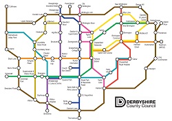
A61 Whittington Moor to Chesterfield College (£0.3 million, part of route 1)
Funded from Local Transport Plan (LTP) resources, new sections of route have been provided from Pottery Lane (Whittington Moor) to the Tesco supermarket and from adjacent to the Casa hotel to Chesterfield College. These sections are linked by a series of toucan crossings at the Lockoford Lane junction with the Tesco access. Exception for one short stretch of route along a quiet road (Thompson Street) it's possible to travel from Whittington Moor to the college and town centre entirely along traffic-free paths.
Station to Queens Park (£1.6 million, part of route 5)
Funded from LTP and external grant (Local Sustainable Transport Fund) this route runs from the rail station forecourt over a series of bridges to meet paths in and around the Ravenside retail park. It can be regarded as a cycle bypass of the town centre and means that the Chesterfield Canal and Hipper Valley leisure routes can be linked with only very limited use of roads required.
Dronfield/Unstone (£0.9 million, connection into route 6)
This scheme, funded from D2N2 Local Growth Fund grant, will provide segregated routes alongside the B6057, providing a significant improvement in the facilities for travel between Dronfield, Peak Resort and Whittington Moor, and onwards into Chesterfield town centre.
A61 Derby Road (£0.3 million, part of route 1)
Currently on site, this scheme provides segregation between pedestrians and cyclists plus additional capacity for both between Horns Bridge and a toucan crossing leading to the Rother Washlands.
Rother Washlands to Avenue (costs to be established, parts of routes 1 and 6)
Under design with a view to securing resources from the D2N2 Local Growth Fund (A61 Growth Corridor) this route would comprise an upgrade of existing routes plus a new section of path south of Storforth Lane leading into The Avenue site.
It is important to note that all new routes which have been created to date are legally available for use by pedestrians as well as cyclists. Some opportunities may arise to create completely segregated facilities, where separate suitable routes exist for all users, but at present segregation, if present at all, is provided through signage and surface markings.
For general enquiries, please contact us.