The Rights of Way Improvement Plan for Derbyshire is attached to this page.
The RoWIP builds on the day-to-day work already carried out with respect to our work on public rights of way and forms a distinctive strand within the local transport plans for the county. It also provides a unique opportunity for us to move forward and plan strategically for how we will improve the management, provision and promotion of a wider rights of way and access network.
Derbyshire's RoWIP covers the whole of the county, including the Peak District National Park and looks at:
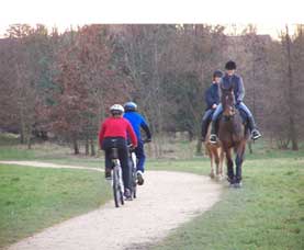
- the extent to which local rights of way (including footpaths, cycle tracks, bridleways, byways, open access land, trails and Greenways) meet the present and future needs of the public
- the opportunities provided by local rights of way for exercise and other forms of open-air recreation and the enjoyment of our area, together with the use of the network by local people as a means to access workplaces, schools and other facilities
- the accessibility of local rights of way for blind or partially sighted people and those with limited mobility or other impairments
Monitoring and delivery
The RoWIP includes a statement of action, which sets out how we propose to manage and improve the network of more than 3,000 miles of paths and trails across Derbyshire to help people to get out and about in the county and enjoy our countryside.
In delivering the RoWIP we have produced annual work programmes in line with the statement of action. We have also produced annual monitoring reports which demonstrate how we have translated the RoWIP into actions on the ground, using funding identified within the local transport plan as well as external grants and other sources of funding.
The monitoring reports highlighting what has been achieved to date are attached to this page.
The 2 local access forums, the Derby and Derbyshire Local Access Forum and the Peak District Local Access Forum continue to play an important part in the whole process due to their role as statutory advisors to the county council on strategic access and open-air recreation.
Statement of action
We have completed the first 5 years of delivering the RoWIP in Derbyshire and produced a Statement of Action to take us through to 2017. This is attached to this page.
The 5 main aims are to:
- ensure that the public rights of way network is open and available for use
- provide an up-to-date and widely available map of public rights of way in the county, known as the Definitive Map and Statement
- provide a more connected, safe and accessible network of paths suitable for all users
- improve the promotion, understanding and use of the network
- encourage greater community involvement in managing rights of way
Some of the specific actions that will be carried out over the next 5 years include:
- surveying a 5% sample of paths each year to make sure that at least 72.5% are easy to use
- providing roadside signposts and waymarks along routes where they are needed
- carrying out an annual programme of surface improvements on key rights of way and trails
- clarifying the legal status of routes and keeping an up-to-date digital map of public rights of way which can be viewed online.
- improving provision for cycling, horse riding and easy access across the county
- completing the Pennine Bridleway National Trail through Glossop
- continuing to develop a network of greenways, including working with partners on the Archaeological Way - part of the Limestone Journeys project in the Bolsover area
- developing safer routes to schools and local services to encourage more walking and cycling
- promoting the wider benefits of the access network for health and wellbeing, tourism and the local economy
- giving greater emphasis to work with local groups and volunteers